
Arizona Maps

Arizona's Rural Health Safety Net
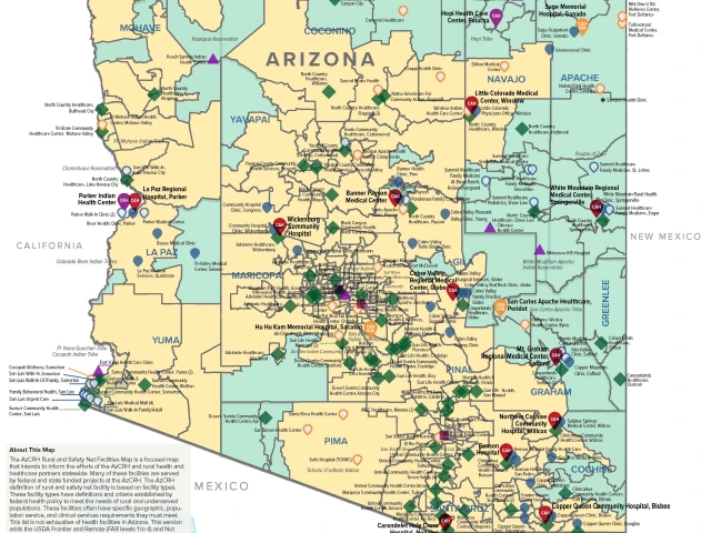
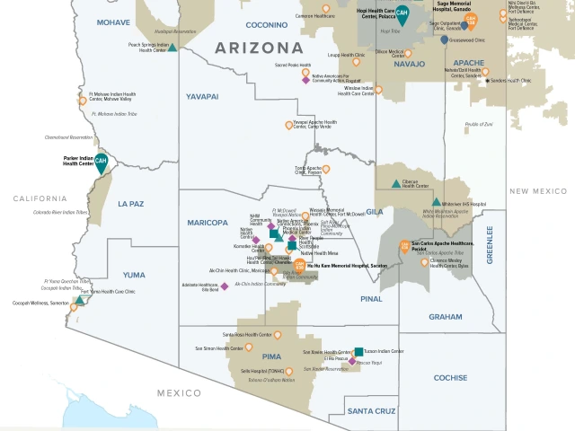
Arizona Critical Access Hospitals, IHS and Tribal Facilities, Rural Health Clinics, FQHCs (updated August 2025)
» Visit the AZCRH ArcGIS Hub for interactive Health Workforce Data and Analysis Maps and Applications
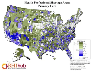
The Rural Health Information Hub offers maps and other useful resources. In addition to maps, RHIhub also as an “Am I Rural?” tool which helps uses identify the rurality of a specific location. Because rural definitions vary by federal and state agency and grant funding, this tool should only be used as a guide.
ADHS and the Bureau of Health Systems Development (HSD) provides resources to the public to support the expansion of primary care services and to reduce health disparities throughout Arizona. The data, reports and maps available through HSD are useful for grant writing, needs assessments, resource prioritization, and other health planning initiatives.
ADHS Health Systems Development Maps (including Primary Care Area, Medically Underserved Area Maps)
The Atlas of Rural and Small-Town America provides statistics by broad categories of socioeconomic factors:
- People: Demographic data from the American Community Survey (ACS), including age, race and ethnicity, migration and immigration, education, household size, and family composition.
- Jobs: Economic data from the Bureau of Labor Statistics and other sources, including information on employment trends, unemployment, and industrial composition of employment from the ACS.
- County classifications: Categorical variables including the rural-urban continuum codes, economic dependence codes, persistent poverty, persistent child poverty, population loss, onshore oil/natural gas counties, and other ERS county typology codes.
- Income: Data on median household income, per capita income, and poverty (including child poverty).
- Veterans: Data on veterans, including service period, education, unemployment, income, and other demographic characteristics.